The Khunjerab Pass
Day 47 – 214 kms – (13185 kms Total)
The first thing we find on Wednesday morning (4th July) is that Mick’s slow puncture has become faster. Closer inspection reveals a small hole, rather than the original diagnosis of a leaky valve. Puncture kit out, but too early in the morning to get it right. 3 attempts later and the small hole was a large hole.
Round the corner to the tyre shop and swapped it for the spare, still leaving time for us to get down to the customs post for opening time with our guide.
Two hours later, just before noon, (09:00 Pakistan time), we were cleared by customs. They didn’t even look in our panniers. We had to take the luggage off the bikes and take it into customs and run it through the scanner but we never mentioned the panniers and they didn’t ask!
We drove away waving farewell.
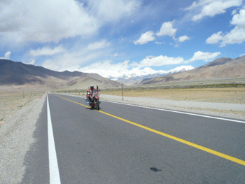
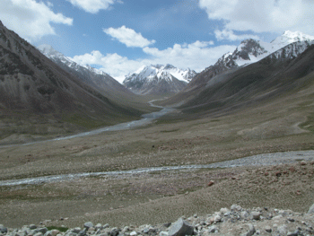
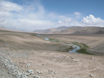
From the customs post, it is 120 km to the actual border. The road runs along the valley of the Tashkorgan river, with the mountains to the right bordering Tajikistan and Afghanistan.
(Cloud covers the tops of most and as the patches of sun reduce, we add layers and warmer gloves. The road rises gradually and soon cuts into the mountains. The ascent sharpens and we reach the Chinese border post where we are waved off and a few kilometres later we reach the physical border. Marked by large stone pillars, a memorial stone and a definitive cessation of black asphalt and return to patchy roads interspersed with stony gravel track.
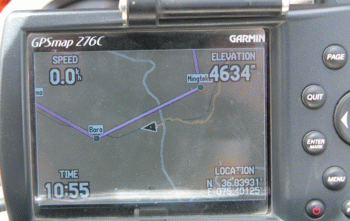
The Khunjerab pass is the highest border in the world, at a height measuring 4720m (depending on the map/GPS).
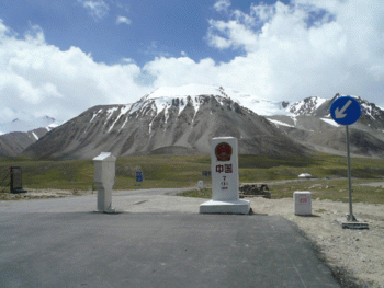
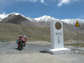
Pakistan
Two hundred meters later, a solitary Pakistani guard greets us with a handshake, and opens the barrier to let us through. The road descends, but photos are rare as our eyes are on the potholes in the road, not the scenery.
The surface improves slightly as we start to descend and although it never reaches the quality at the end of China, the holes are less and solid surface become more regular until we reach the part that the Chinese Agent said had been washed away. It had only just been repaired. They used football sized rocks and made the going difficult in that part. The repaired section was only one truck wide so we had to dive into holes on the rock face side to let them pass.
We were not going ANYWHERE near the river edge!
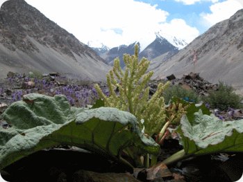
The road follows the Hunza Valley through some fantastic scenery. We go through three checkpoints before reaching the real border post at Sost.
It is 13.50 local, we have gained three hours. Immigration is closed until 2pm, but once opened, we are processed fairly swiftly and are handed a card for a local hotel. 200m down the road we find customs and deal with the paperwork for the bikes – 20 minutes, a far cry from the 5 days it took in China.
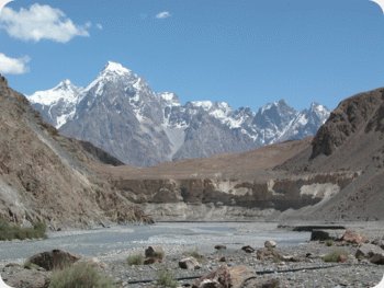 We find the hotel Khunjerab and check in to a 500rupee room (6 Euro), which is basic, but the food we buy is good (and plenty of it!). A Tasmanian couple, (Tim & Kate), are also staying. They are en route to China, so we spend the evening swapping tales.
Mick, you are having too much fun mate for an owd git !!!! take care fella, will try and take a trip down when you return to blighty.
Treeve from Wiggin | 12 July 07 | #Slight correction. The highest metalled motorable pass in the world is Khardongla in India at 5580m
The secon, 3rd & 4th are also in India ;
Changla at 5395m
Tanlangla at 5340 m
Lachlangla at 5275 m
Wish I was with you guys
Have fun & meet you in Pune. Anji
Commenting is closed for this article.
 John & Mick's BIG Adventure